In Vancouver, we are lucky enough to be surrounded by nature in every direction and we are also lucky enough to have a public transport system that can get us to a lot of that nature. All of these hikes you can get to using your compass card!
Other hikes/areas that aren’t listed below offer some private transport. Both Cypress and Seymour Mountain have private buses that take you to the mountain top activities but only in the winter (find my Vancouver snowshoe guide here). You can also take a private bus service to other popular hiking locations like Squamish and Whistler.
Another option is renting an Evo or Modo for the day. There are lots of ways to experience the nature of Vancouver without owning a car, but the list below is focused on hikes you can reach within the metro Vancouver transport system.
The mountains are still wilderness areas so it takes about an hour to reach most of them from downtown Vancouver. For this same reason, many of these hikes will drop you off a little ways away from the trailhead. All of the hikes I have listed below add a max 1km walk on either end of the hike between the trailhead and the bus stop.
Hikes Accessible by Bus in Metro Vancouver
Table of Contents
1. Pacific Spirit Park, Vancouver
Pacific Spirit Park is a gorgeous park that has many different walking trails through the forest and along the beach. It’s not hiking up the side of a mountain but will give you your nature fix. This is a large park with many different bus lines that run nearby. I would recommend doing a google maps search to find the best public transit route for you.
2. Stanley Park, Vancouver
Everyone knows Stanley Park. A solid 9km or so walk around the seawall with stunning views all the way around. Another non-mountain trail, but beautiful and worthwhile and will get your exercise in as well. This is another place that has a few different ways of getting there depending on where you live so I would recommend using google maps to determine the best public transport route for you.
3. Quarry Rock, Deep Cove
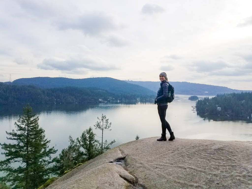
Quarry Rock is a short 3.8km hike with minimal elevation gain (though there are a lot of stairs so it will still get your heart rate up) and with a nice view of the ocean and the town of Deep Cove. This coastal walk is excellent year-round. There are other ways to access this hike and make it longer which you can read about in my full guide to Quarry Rock here.
To get to Quarry Rock you can take the 211 or the 212 bus from Phibbs Exchange on the North Shore. It’s about a 1 hour trip from downtown Vancouver. Get off at Panorama Dr and Naughton Ave and walk North on Panorama Drive (you cross the main street then continue towards the forest). The trailhead will be on your left after a few blocks.
4. Lighthouse Park, West Vancouver
Lighthouse Park is a park in West Vancouver with a plethora of different trails and featuring, you guessed it, a lighthouse. It’s a very photo worth spot and you can walk up to 6km or as little as 500m. This park has minimal elevation gain and is great to visit in all-seasons and all-weather. To learn more about Lighthouse Park you can read my full guide here.
To get to Lighthouse Park you take the 250 bus and it’s only about a 45 minute trip from downtown. Keep your GPS out on the bus to ensure you get off at the right stop as it’s easy to miss. Alternatively, you can ask the driver to alert you when it’s time to get off. Get off at Marine Drive and Beacon Lane and continue the short walk down Beacon Lane to reach the park entrance.
5. Capilano Canyon, North Vancouver
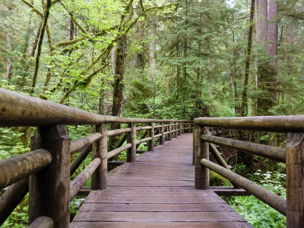
Capilano River Regional Park, home of the Cleveland Dam, is a fantastic year-round, all-weather hiking destination. The longest loop is 8km and there’s lots of room to explore and find a trail that matches your hiking preferences. The beautiful bridges, rushing water, picturesque dam, and moss-covered forest are all beautiful attractions.
To get to Capilano Canyon take the 236 bus line and get off anywhere between the Fish Hatchery Entrance and the Cleveland Dam Parking lot. You can reach my full guide to Capilano Canyon here.
6. Goat Mountain, North Vancouver
The Goat Mountain trail starts at Grouse Mountain Resort, which is at the top of Grouse Mountain. The resort is either accessible by paying for a roundtrip gondola ride or you can add an extra 5km by taking the BCMC trail on either end of the Goat Mountain trail.
The BCMC runs parallel to the Grouse Grind and allows people to go both up and down it, unlike the Grouse Grind which only allows one-way traffic.
The gondola costs about $68/pp round trip. It is your choice whether you want to hike or ride the gondola, it just depends on what you are up for and what you are willing to pay for. There are some great tourist attractions at the resort in the summer that are a lot of fun and you may want to consider that.
You can find the Goat Mountain trail at the far end of the resort area. I’d recommend downloading a map because the intersecting trails can be confusing.
The trail is 7km long starting from the resort (so add another 5km if you choose to take the BCMC) and about 400m of elevation gain (the BCMC adds another 700m, it is steep!) The last 500m or so of the trail are steep with quite a bit of scrambling but the mountain and city views at the end are stunning.
Both the 232 and the 236 bus go to the base of Grouse Mountain (last stop). It drops passengers off near the gondola and you can walk down the hill a little and across the road to get to the BCMC trail.
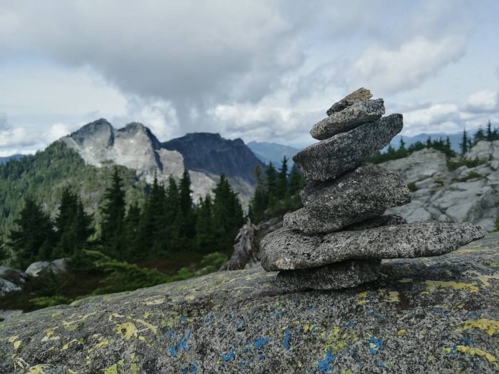
7. Crown Mountain, North Vancouver
Crown Mountain is also accessible from the Grouse Mountain Resort so take the same directions as above and if you choose to take the BCMC to add 5km and 700m of elevation gain.
Starting from the resort the trail is 9km with 900m of elevation gain. The rough part about this trail is that you hike up the same trail as you would to Goat Mountain and as the trail forks upwards to Goat, you have to take the fork that goes downwards to continue to Crown. You have to go down into a valley and then climb back up another mountain to make this summit.
Having to basically conquer two mountains in one day always messes with my mind more than anything else, and because of that, this can be quite a grueling hike. Be sure to allow plenty of time to complete this one, especially if you are adding on the BCMC trail on either end. If you do complete it you will be rewarded with great views!
8. Lynn Canyon, North Vancouver
Lynn Canyon is best known for its suspension bridge and cascading water. It’s a beautiful area year-round, one I especially like going to on a rainy day because it is quieter and the green colors pop with a little added moisture. The basic loop is only about 3km but you can add on many different trails to make this a longer day.
To get to Lynn Canyon take the 227 bus to Duval road and walk the last 500m or so to Lynn Canyon Park.
9. Hanes Valley Trail, North Vancouver
This is a great public transit option because it is a point-to-point trail and even a person driving there would likely need two cars to complete the trail.
To get to the trailhead you can take the 227 bus to Duval Rd at Lynn Canyon. From Lynn Canyon, you follow the 17km trail with 1300m of elevation gain. You follow the river and then wrap around the back of Grouse Mountain finishing at Grouse Mountain Resort, you can then take the gondola down ($15/pp 2019) or add an extra 3km to walk down the BCMC trail where you can catch a bus back home. This challenging trek has some rugged parts and offers beautiful valley views.
10. Kennedy Falls, North Vancouver
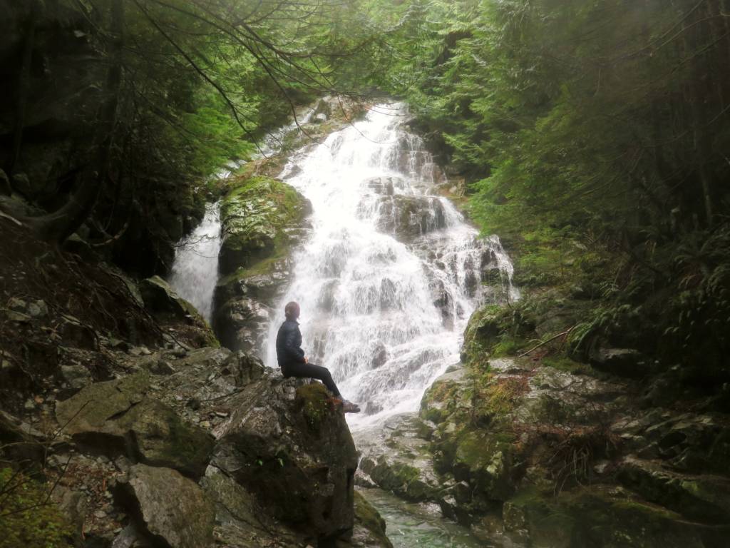
Kennedy Falls is a 12km hike with about 500m of elevation gain. You will be rewarded with a beautiful forest and a big waterfall. Be prepared for several stream crossings so wear proper footwear. This is a year-round, all-season hike but snow will hang around longer here than in the city because the forest is dense so consider that when winter hiking.
To get to the trailhead take the 210 bus and get off at Coleman Street. Continue to walk down Mountain Hwy (don’t worry, it’s not really a highway, it’s a pretty nice residential/forested area) for about 1km and look for the trailhead. It starts around the Mount Fromme Parking Lot. There are lots of mountain bike trails here too so make sure you download a map before you go.
11. Mount Fromme, North Vancouver
There are a couple of ways to summit Mount Fromme but the more well-traveled option is via St George Ave. There isn’t much parking here so going by public transit is a great choice. Take the 230 bus from Lonsdale Quay and get off at St George Ave and walk up the road a few blocks to the end of the cul-de-sac when you will find the trailhead.
This 10km hike has nearly 900m of elevation gain. You don’t get big 360 views but it’s still a nice hike. Be sure to download a map before you go because it can be confusing with intersecting trails and the occasional washed out sections.
12. NorVan Falls, North Vancouver
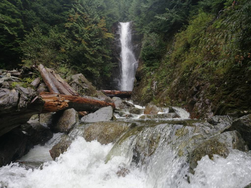
NorVan Falls is a 14km trail with minimal elevation gain. It’s a great hike for any weather and can be done all year round as long as there hasn’t been heavy sea-level snowfall. You will be rewarded with a tall waterfall at the end.
Bus 210 will get you 1km from Lynn Headwaters Regional Park, get off at Ramsay Rd and you can walk part of the way there on the Baden Powel Trail until you hit Lynn Valley Rd. Overall it’s not a bad 1km to add onto either end of the trail since it’s mostly in the trees.
13. Coliseum Mountain, North Vancouver
Coliseum starts at the same place at NorVan Falls so take bus 210 which will get you 1km from Lynn Headwaters Regional Park, get off at Ramsay Rd and you can walk part of the way there on the Baden Powel Trail until you hit Lynn Valley Rd.
The Coliseum trail also follows the NorVan Falls trail for the first 6km or so. Then gets significantly more difficult and is quite a long trail. Plan to be there all day so if you are taking the bus make sure you leave very early. This trail is 23.5km long and has 1350m of elevation gain. You will be rewarded with beautiful 360-degree views at the top so it’s well worth the climb.
You can continue on this trail for another kilometer or so to Mount Burwell for some more fantastic views.
14. Lynn Peak to South Needle to North Needle, North Vancouver
This trail also starts at the same place as NorVan Falls and Coliseum, so take the same 210 bus and walk to the trailhead.
This hike can be extended as far as you like depending on your energy level. Lynn Peak is the first note-worthy peak at 12km and 1000m of elevation gain. It’s a challenging trail that will lead you to a view of the city.
From Lynn Peak, you can continue along the ridge going slightly up and down between mountain peaks. Add another 2km and an extra 350m of elevation gain and you will find yourself at South Needle for some fantastic views, you can continue a bit further to North Peak but the trail keeps getting more rugged. South Needle will probably have the best reward for effort ratio. Leave lots of time for this hike and download a map.
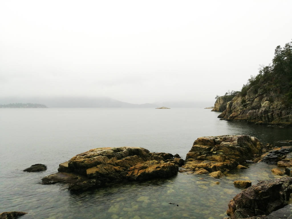
15. Jug Island, Belcarra

Jug Island is a 5km trail in a beautiful forest. The trail ends at a cute beach with views of a little island and the mountains behind. This is a great year-round all-weather hike with some elevation gain that can get your heart rate up a bit but is overall a pretty easy walk.
It takes about 1.5 hours to get to the Jug Island trailhead by public transport if you are going from downtown Vancouver so I would recommend this hike if you live farther east like in Port Moody or Coquitlam. To get to Jug Island you can take the Millennium Line train to Moody Centre Station then transfer to the 182 bus, after about 35 minutes get off at Midden Road which is just past the trailhead. Walk a little back on the road and you will find the trailhead.
16. Eagleridge Bluffs via Horseshoe Bay

Eagle Bluff is normally accessed from the Cypress Mountain Resort area via Black Mountain; however there is an alternative route that you can start near the Horseshoe Bay park and ride. This route takes you on the Baden Powell trail for 11km with 1000m of elevation gain.
This is a much more challenging route than the more popular option of going via Cypress but it is well worth it for the stunning views you get at Eagle Bluffs. This trail could also be used earlier in the year than the one starting at Cypress because it starts at sea level.
To get to the Horseshoe Bay park and ride you can take the 250 bus to Horseshoe Bay from downtown Vancouver. The ride take about an hour. From the park and ride you have to cross over the ferry traffic so please be careful.
If you are really up for a challenge you could follow the hike all the way to Cypress and continue on any of the other trails but that would make for a very long exhausting day.
17. Mount Gardner, Bowen Island
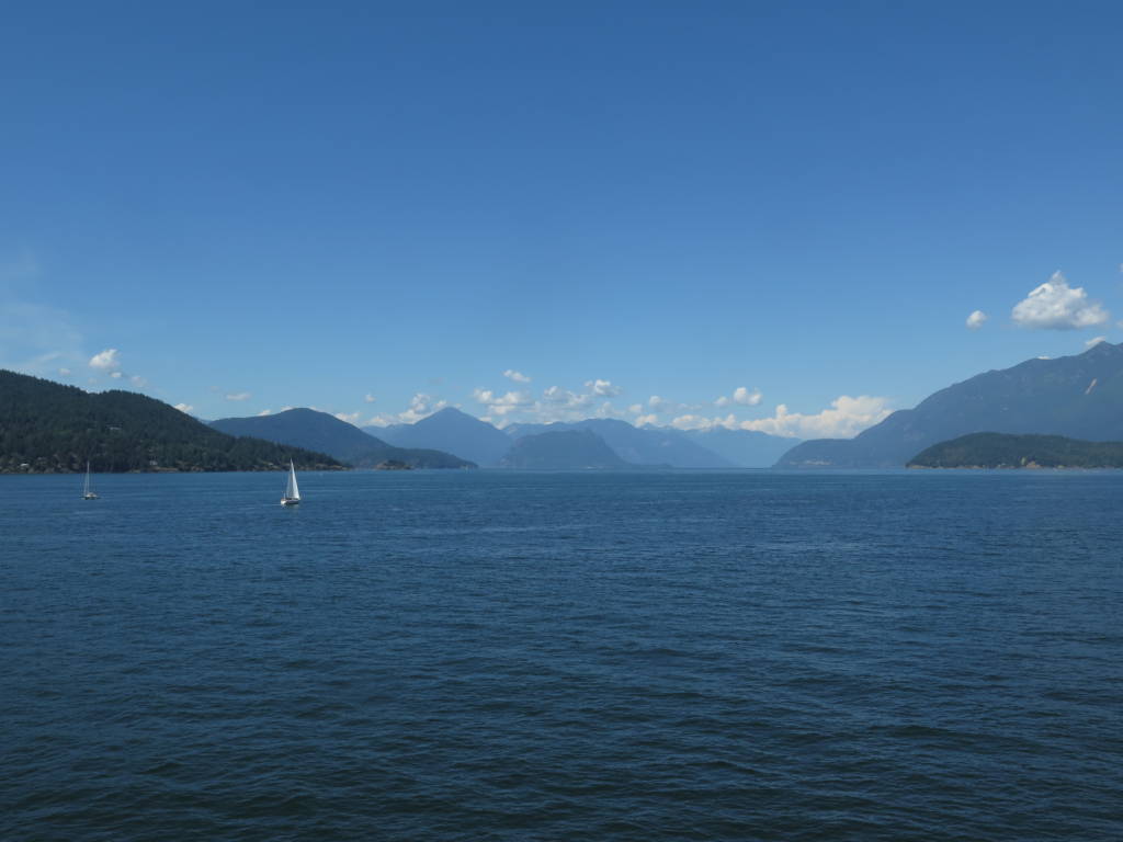
I am not sure if I should really include this hike on this list because you have to take a ferry to get to it, but it’s still only about a 1.5 hour trip to get to a great hike, with no car required and makes an excellent day trip from the city.
The Mount Gardner and Killarney Lake Loop starts almost immediately after you get off the ferry on Bowen Island. The trail is 16km long with 800m of elevation gain, it has a nice gradual incline so I’d only rate it as moderate though it is quite long. You will be rewarded with gorgeous views of the surrounding islands, ocean, the city, and mountains and it is normally accessible year round.
You could easily do this hike in the morning and enjoy the rest of Bowen in the afternoon. There are other shorter hikes on Bowen Island as well, if you want to learn more about them you can read my Bowen Island day-trip guide here.
To get to Bowen island you take the 250 bus from downtown Vancouver to Horseshoe Bay and then take the ferry to Bowen Island. After disembarking the ferry you can find a map of all the hikes on the island in a small kiosk that will be on your left-hand side. The ferry leaves every hour and 10 minutes or so, the crossing takes 20 minutes, and the ferry costs $10.50 per person round trip, no need to book in advance!
Conclusion
I hope you have found some new hikes that you can access without a car. If you’re considering getting a car, check out Chris’s article on the benefits of owning a car in Vancouver. Happy Hiking!


Welcome to Alpine Feeling! My name is Talon, an outdoor enthusiast who has spent extensive time in the mountains of Vancouver, Washington State, and the Canadian Rocky Mountains.