At a Glance
Table of Contents
| distance: up to 6km | elevation gain: 150m | type: loop | rating: easy |
| dog friendly: yes | road/parking: mostly paved, free | public transport: yes | season: year-round |
Lighthouse Park in West Vancouver has gorgeous views of Bowen Island and the city of Vancouver, the way the ocean hits the smooth rock coastline, and the lush greenery of the forest, backed with glimpses of a red and white lighthouse makes this a great year-round hike/walk in the woods. In the summer its a great place to bring a picnic and a book and spend the day on one of the large smooth rocks along the coastline and in the winter, the rain makes the green foliage light up and the fog that rolls in around the skyline makes it mystical.
Trail Description
Lighthouse park has a series of many different trails, and it’s fun to just wander around and explore and see what you can find.
It’s possible to park and walk right to the lighthouse area on a short, hard-packed, wide path, or it’s possible to feel much more connected to nature by taking one of the lesser traveled paths. I will be describing one of the longer loops which is around 5km, depending on how many detours you take.
I recommend parking and then entering the park through the metal gate at the far end of the parking lot, almost immediately after the gate on your left there is a sign for the Salal Loop, follow this path and turn right at the fork and you will be following the Arbutus Trail down towards the sea. There are many little extra loops and detours you can take along this path and feel free to check it out.
There is cell service so try to keep a map available on your phone. If you ever do feel lost, just make your way towards the sea and you should be able to find your way from there.
The path will curve to the right and you will pass Eagle Point (a short detour), from here you will be able to see a view of the Vancouver skyline to your left and the lighthouse to the right. Get back on the main trail and turn left, when you hit the next fork you will turn left onto the Valley Trail and make your way towards the lighthouse. Here you will find picnic benches, cabins, a washroom, and Beacon Trail which will lead you easily and directly back to the parking lot if you decide you are finished hiking for the day.
Just past the cabins, you will find the lighthouse viewpoint (on top of a small hill), take a moment to look around then head back down the hill and continue along the trail (you will be heading west), until you come across West Beach Trail, take this small detour for the best views of the lighthouse (in my opinion). Head back up the trail and continue along to Shore Pine Trail, and eventually meet up with Juniper Loop which will take you back to the parking lot (stay right) or head out in the opposite direction for another loop/viewpoint.
There are many other little detours along the way and please stop at and and all of them, they are all magical in their own way. Make sure you take the trodden trail between the viewpoints and the main trail. Be mindful of the shrubbery you may be destroying beneath your feet and take it from someone who has accidentally taken the wrong “trail” several times, it doesn’t get you to the next spot any easier or faster.
Photo Journey
Right after the metal gates that lead you into the park, turn left onto Salal Loop
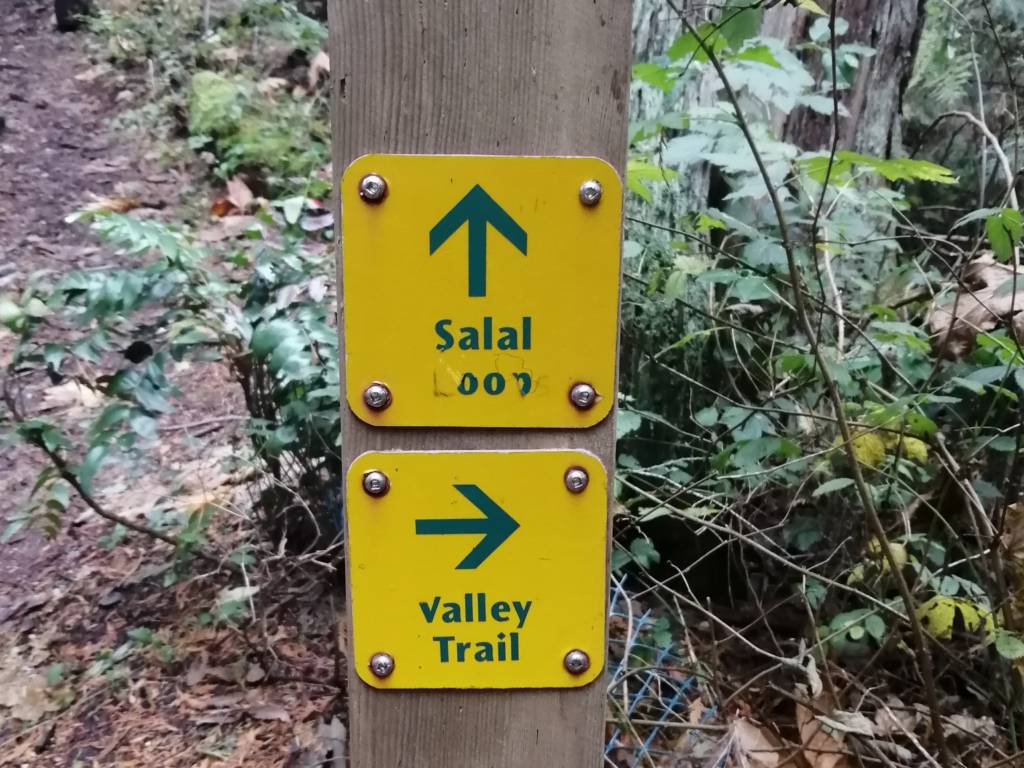
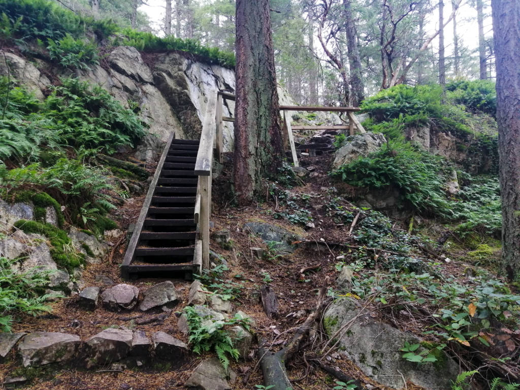
Turn left again, and make your way towards the ocean, feel free to take any little detours or extra side loops, but keep a map on hand. On your way down Arbutus Trail find lots of little staircases made out of wood and stone:
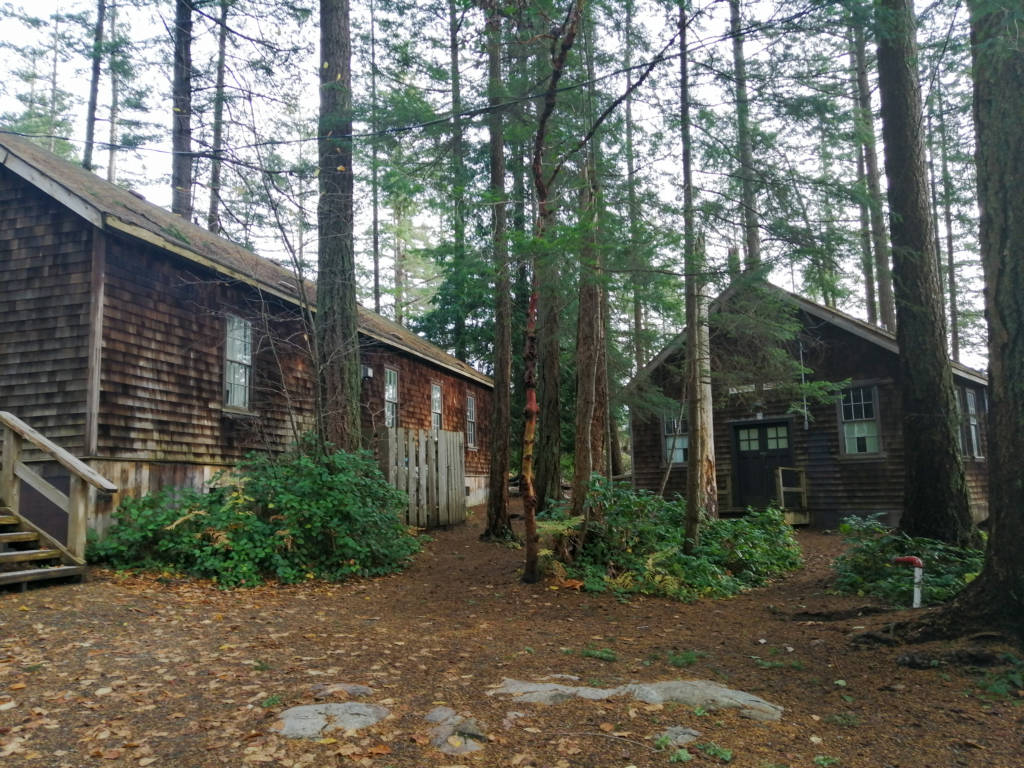
Make stops at Eagle Point and Starboat Cove if you feel inclined. After an especially steep decline you will turn left onto the Valley Trail and make your way to the lighthouse area where you can find several facilities inside and around these cabins:
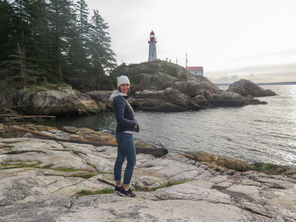
Continue straight and climb up a large rock to get to the lighthouse viewpoint, head back down the rock, and continue on the same trail heading west. I recommend taking the short detour to West Beach for this view (and others):
Get back on the main trail and follow Shore Pine Trail to Juniper Loop and then back to the parking lot. Points of interest along the way include Shore Pine and Juniper Points.
Accessibility
Driving to Lighthouse Park is a little bit weird, you drive through neighborhoods and it might seem like you have taken a wrong turn on your first trip there. Keep google maps up and prepare for a winding drive downhill (check out all of the nice houses along the way!). There is also bus access that will take you very near Lighthouse Park via the 250 bus, make sure you watch your phone GPS to get off at the right spot or ask the driver when you get on. You can find other public-transport accessible hikes here.
Facilities
There are picnic benches and pit toilets near the parking lot, and picnic benches, flush toilets, and a water spigot near the lighthouse/cabins.
Tips/Additional Info
The trails can become little streams during/after rain and the rocks can be slippery so wear proper footwear. Please note that the lighthouse is not open for tours.
If you want to explore other year-round hikes near Vancouver, check out my guide here.


Welcome to Alpine Feeling! My name is Talon, an outdoor enthusiast who has spent extensive time in the mountains of Vancouver, Washington State, and the Canadian Rocky Mountains.