Bellingham has many beautiful trails, many of them lead to lakes or forests but there are some that have breathtaking mountain top views as well. Almost any hike at Mount Baker will have incredible views, and I have included my favorites. To see all of the best hikes on Mount Baker find them here, to see all of the hikes near Bellingham (non-Mount Baker) find them here.
Bellingham Hikes with Views
Table of Contents
Bellingham Area

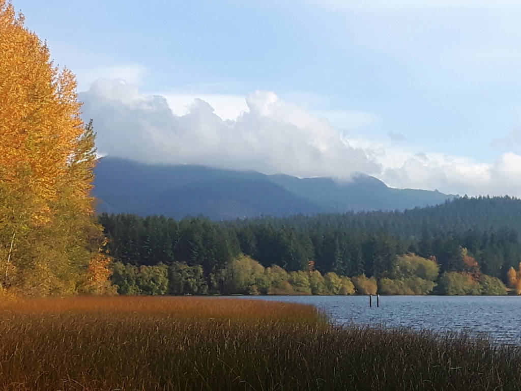
1. Raptor Ridge/Chuckanut Mountain/ Pine and Cedar Lakes
Distance: 5.5 miles+ | Elevation Gain: 1900ft | Difficulty: Challenging
Starting at the trailhead off Lake Samish road (south of Bellingham) this trail gains elevation quickly and is a leg burner until you start to level out and reach a junction where you can head to Chuckanut Mountain, Raptor Ridge, or Pine and Cedar Lakes.
Chuckanut Mountain does not offer too many views itself but Raptor Ridge offers beautiful views of Mount Baker. After checking out Raptor Ridge I would then recommend backtracking and taking the opposite junction to the lakes, which are serene and lush. You can of course just visit one of these destinations, but it does not take much extra time or effort to go to both.
Another option for this trail is to start near Arroyo Park in South Bellingham. This version of the trail is longer but the elevation gain is more gradual. The route you choose up to personal preference.
The trail is decently marked but I would still recommend downloading a trail map as there are many intersecting trails in the area. This trail can be done year-round but be cautious of ice and potential residual snow in the winter months.
2. Lost Lake
Distance: 5 to 12 miles | Elevation Gain: 1300 to 3200ft | Difficulty: Moderate to Challenging
This trail does not simply go to a lake, it also takes you above the lake where you will get incredible views of the bay and of Mount Baker. Like most hikes in this area, there are several different ways of accessing it. You can either drive up to the top of Cleator Road and eliminate a lot of elevation gain, from here I would take the Rock Loop trail.
If Cleator Road is closed, or you want more of a workout, you can park along Chuckanut Drive (Discover Pass required) just south of Larrabee Campground and hike up the mountain towards Lost Lake and the lookouts.
This trail has the potential to be hiked year-round though take caution in the winter and watch out for ice and residual snow on the trail. Download a map before you hike here as there are many intersection trails that can be confusing.
3. Alger Alps
Distance: 4.3 miles | Elevation Gain: 1000ft | Difficulty: Moderate
This hike is accessed via a short drive south on I-5 to Alger. The trail is uphill most of the way but it is an old road so the terrain is even, wide, and a nice gradual slope. Overall, this hike a nice short workout that leads you to a lookout where you can see the patchwork farmland below you in the valley and the ocean and mountains beyond.
The trail is straightforward and can usually be done year-round. Of course, consider if there has been any low-level snow and watch out for ice in the winter months.
4. Lookout Mountain Trail (from Chain Lake in Alger)
Distance: 8.5 miles | Elevation Gain: 2500ft | Difficulty: Moderate
This hike is just north of the Alger Alps hike (above). It is overall longer, steeper, and more challenging than Alger Alps but definitely worthwhile. The viewpoint is actually about a half mile before the summit (so save your steps) where you will get views of the lake below and the surrounding mountains in the distance.
This trail will have snow in the winter months, and I would not recommend hiking here even in snowshoes, as there can often be blowdown blocking the path. There are a few trail junctions as well so be sure to download a map before you go.
5. Lummi Peak Trail
Distance: 6 miles | Elevation Gain: 1600ft | Difficulty: Moderate
This trail involves a ferry to get to the trailhead, which makes for a fun adventure. The Lummi Island ferry is only a short drive north of Bellingham and the small ferry only takes 5 minutes and runs every 20 to 40 minutes.
The hike itself is steep at first and then evens out and allows you to enjoy the trail until you reach a big cliff with views of the San Juan Islands.
This hike can normally be done snow-free year-round as long as there hasn’t been low-level snowfall or below freezing temperatures causing ice.
This trail is on protected land to be sure to follow Leave No Trace Principles and do not bring your pet.
6. Oyster Dome
Distance: 6 miles | Elevation Gain: 1900ft | Difficulty: Challenging
This is probably the most iconic hike in Bellingham and everyone should do it at least once. The trail starts on Chuckanut Drive, and there is only road shoulder parking available so arrive early on a sunny weekend to ensure you get a spot.
The walk up the mountain is definitely a leg burner as you go straight uphill the majority of the way but at the top, you will find a lookout with big views of the ocean and the islands beyond. Be sure you go on a clear day so that you can enjoy these views.
This hike is pretty straightforward and there are lots of people around to ask for directions if you feel lost. There are a few trail junctions to watch out for and there are some trail extensions if you want to have a longer day. If you feel up for more hiking, be sure to download a map of the area.
This trail can be done year-round, but take caution in the winter months as there can be some snow or ice depending on recent weather patterns.
7. Blue Mountain
Distance: 5 or 10 miles | Elevation Gain: 1100 or 2100ft | Difficulty: Moderate or Challenging
This quieter hike is located near Acme which can be reached by driving along the south side of Lake Whatcom, or by taking I-5 south and then backtracking up Highway 9 north.
This hike can be tricky to navigate because it is technically an active logging road. The logging road is often not in use and is marked as such by a closed gate at the bottom of the road. If the gate is closed, that means that the hike is open to walkers, if the gate is open, it is too dangerous to walk on foot with large trucks going up and down.
I know that a logging road doesn’t sound very appealing to hike on but it is well worth it. There are views along the way and at the end, you will find beautiful views of either Mount Baker or the Twin Sisters mountains.
Since it is a road there are plenty of exposed sections so be sure to bring sun protection and plenty of water. There are several intersecting roads as well so be sure to download a map before you go to ensure you make it to the summit of your choice.
There are two trail options here: the south summit, which is the shorter option and boasts views of the Twin Sisters, or the north option which is longer and more challenging but boasts views of Mount Baker. Both are fantastic options and it is up to you which one you choose.
In the winter, these trails will get snow on the top half, and if there has been enough heavy snow it can be a great place to go for a snowshoe especially as the ground is even, wide, and well maintained.
Mount Baker Hikes with Views

Mount Baker is about a 1.5-hour drive from Bellingham, and some trails are deep into rough forest roads that are hard on small cars and some are just off the highway. No matter what you choose, all of the trails are incredible and boast beautiful views. I have chosen a “few” of my favorites and listed them below.
All of these trails are only accessible in the summer (usually July through September) unless they are noted as a snowshoe trail. You will need a Northwest Forest Park Pass to park at any of these trailheads. Find out about more hikes at Mount Baker here.
8. Bagley Creek and Fire and Ice Loops
Distance: 0.5 to 2 miles | Elevation Gain: Minimal | Difficulty : Easy
There are several short and sweet hikes that start near the Heather Meadows Visitor Center (near the Mount Baker Ski Resort) which includes Bagley Creek and the Fire and Ice Trail.
The Fire and Ice Trail is only a half-mile and is a beautiful place to stretch your legs, for even more alpine views you can continue on the Bagley Creek Loop, or even add on Chain Lakes or Table Mountain (both are listed below). You will find mountain and lake views and you will have a fun time crossing the bridges and checking out wildflowers. In the winter Bagley Creek is also a snowshoe trail.
9. Table Mountain, Artist Point, and Huntoon Point
Distance: Up to 3.5 miles | Elevation Gain: Up to 800ft | Difficulty: Easy/Moderate
In the summer you can drive right up to Artist Point at the very end of Mount Baker Highway and then do the short walk to Huntoon Point. There are some stunning views from here and makes for a great adventure for a beautiful drive and a picnic.
From here, you can also head out in the other direction and go to Table Mountain, where you will find more beautiful mountain views. In the winter months, you can snowshoe from Mount Baker Ski Area to Artist Point.
10. Winchester Mountain and Twin Lakes
Distance: 3.1 miles | Elevation Gain: 1300ft | Difficulty: Moderate
This hike is stunning and has an idyllic old fire lookout and the most incredible views of the mountains and the lakes. When you take into consideration that this hike is on the easier side, it has a fantastic reward for effort ratio.
The catch is that the drive to get to the trailhead is horrible. Take forest road 3065 towards the Yellow Aster Butte Trailhead and then keep going. I would highly recommend a 4WD vehicle with high clearance and a lot of patience.
11. Chain Lakes
Distance: 6.5 miles | Elevation Gain: 1800ft | Difficulty: Moderate
This loop starts near the Mount Baker Ski Area. If you want a very rewarding hike that keeps you in nature for a while but isn’t too challenging and doesn’t require any backroad driving, this is the hike for you.
There are stunning views of lakes and mountains throughout, and you will find wildflowers and fall foliage along the edge of the trail depending on what month you go in.
Be sure to go counterclockwise to get the best views and be sure to bring sun protection as the hike is quite exposed.
12. Ptarmigan Ridge
Distance: 11.5 miles | Elevation Gain: 2400ft | Difficulty: Moderate
Like chain lakes, this hike starts near the ski area so the drive to get to the trailhead is paved and easy-going and though the hike is long, the elevation gain is gradual making this hike an excellent day out in nature. You will find stunning mountain views and wildlife sightings without having to do any scrambles or steep endless inclines.
13. Heliotrope Ridge
Distance: 5.9 miles | Elevation Gain: 2000ft | Difficulty: Challenging
Though this hike does offer some beautiful mountain views, the highlight of this trail is the massive glacier you can get very close to at the end. Though you can look out into the horizon you will surely be more mesmerized by this giant piece of ice and its deep shifting sounds that are not quite like anything else.
This is a very popular hike so be sure to arrive early on a sunny weekend to get a parking spot. The road to the trailhead is an old forest service road (#39) so be prepared for a long rough drive.
There are also several stream crossings and some places where the trail diverges so bring solid shoes and a downloaded map.
14. Skyline Divide
Distance: 8 miles | Elevation Gain: 2600ft | Difficulty: Challenging
This hike starts by conquering a large portion of the elevation gain in the first half which is forested, you will then emerge onto a ridge where you get your first big mountain views. Continue on to the right and follow the ridge for more and more views. Eventually, you will find a large flat spot that signals the end of the hike. The trail continues on to Hadley Peak so walk as far as you feel interested then turn around.
Note that this trailhead is at the end of a long forest service road (#37) that is heavily potholed. Be prepared to go very slow and drive a 4WD if possible.
15. Yellow Aster Butte
Distance: 8.7 miles | Elevation Gain: 2800ft | Difficulty: Challenging
This hike starts out steep and forested before emerging into a more alpine environment where you will get mountain views and wildflowers (including yellow aster) and your legs will get a bit of a break before the last very steep section that takes you to the summit where you will find incredible 360 mountain views.
You can also continue on to Tomyhoi Peak if you are looking for a longer day or multi-day trek.
This trailhead is on forest service road #3065 so be prepared for a long potholed drive, take a 4WD vehicle if possible.
16. Excelsior Peak (2 ways)
Distance: 5.2 miles or 8.4 miles | Elevation Gain: 1600ft or 3600ft | Difficulty: Challenging
The way you do this hike will largely depend on what kind of vehicle you have/how car sick you get. The shorter option includes a long drive up forest service road #31 to the trailhead which starts at the Damfino Lakes trailhead. This road can often be closed due to downed trees or snow.
The other option is to start just off of Mount Baker Highway where you will have a much steeper hike, but still equally as rewarding with incredible 360 mountain views that are not to be missed.
17. Hannegan Peak
Distance: 9.6 miles | Elevation Gain: 3100ft | Difficulty: Challenging
This hike is beautiful and popular so arrive early on a sunny weekend. The views at the end and along the way will get you up close and personal with Mount Shuksan and the other mountains in the area are just as beautiful. Also, keep an eye out for wildflowers and wildlife.
The hike is long and challenging but the elevation gain is mostly well dispersed except for a final push at the end that is very steep. Be sure to download a map before you go because this trail does diverge to Hannegan Pass (instead of Hannegan Peak) so you want to make sure you take the correct turn.
This trail does start at the end of a forest service road (#32) so be prepared for a rough long drive, take a 4WD vehicle if possible.
Conclusion

Enjoy all of the incredible views that the Bellingham area has to offer and happy hiking!


Welcome to Alpine Feeling! My name is Talon, an outdoor enthusiast who has spent extensive time in the mountains of Vancouver, Washington State, and the Canadian Rocky Mountains.