West Vancouver has some gorgeous hiking trails and views to check out. The main area is Cypress Mountain but there are other beautiful places to get out and explore as well.
If you are looking for North Vancouver’s (Seymour and Grouse Mountain) best trails you can find them here. If you want to go a bit further north to the Sea to Sky Hwy and the area around Lions Bay, you can find my guide to those hikes here.
West Vancouver Hikes Ranked By Difficulty
Table of Contents
1. Lighthouse Park
Distance: Up to 6km | Elevation Gain: 200m | Difficulty: Easy
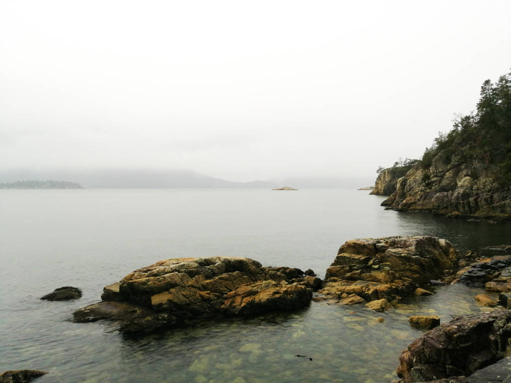
When I think of West Vancouver, I think of Lighthouse Park. This park has up to 6km of hiking trails but you can also walk directly to the lighthouse in a few hundred meters so. There are some hilly parts so you can choose to get a little workout in, or you can choose to take it easy and enjoy the landscape. There is something for everyone.
There are lots of big smooth rocks you can explore, lounge on, and watch the waves crash on as well as beautiful dense forest and views of the city.
There is a big parking lot but it fills up fast on the weekend. You can also take the bus here! This is a great park year-round and in any weather (but be sure to wear waterproof shoes in the rain). Find my favorite trail option here.
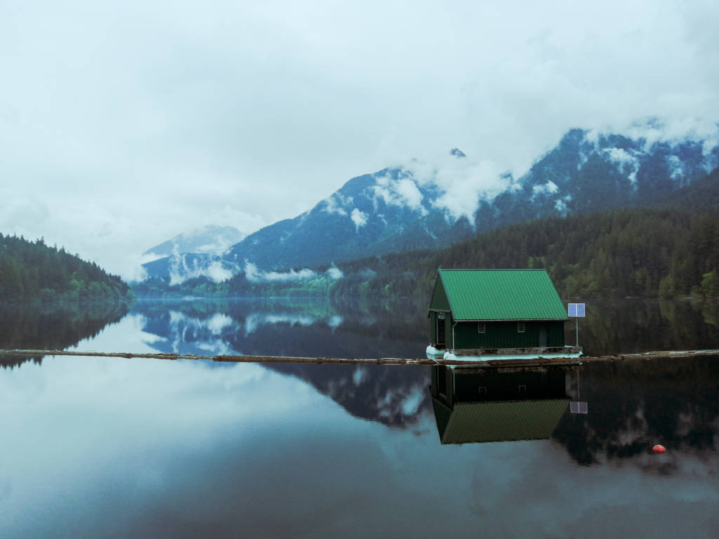
2. West Lake via Hollyburn
Distance: 4.5km | Elevation Gain: 100m | Difficulty: Easy
There are several easy forested trails that start near the cross country ski area at Cypress Mountain that take you to West Lake. Hollyburn trail is one nice option but you can definitely download a map of the area and make your way around the different trails and explore.
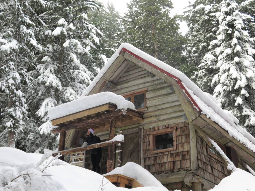
This area has several other lakes such as Lost Lake and Blue Gentian that you can add on as well. This area is also home to the Hollyburn Ridge Cabins which are adorable little cabins in the woods that you can walk past and dream about living in.
This area is also good for a little snowshoe (or microspike) walk in the woods in the winter as well.
3. Cypress Falls
Distance: 2km | Elevation Gain: 150m | Difficulty: Easy
This is a great short hike to some sweet falls that can be done year-round. The falls are up a hill so it’s a small workout but mostly easy. Be sure to make your way to the upper falls to get the best viewpoint. The trail to get there isn’t super clear so be sure to download a map before you go.
There is also a connector trail to Whyte Lake (below) if you want to make the trail a bit longer, but it is nothing to write home about.
4. Whyte Lake
Distance: 5km | Elevation gain: 200m | Difficulty: Easy
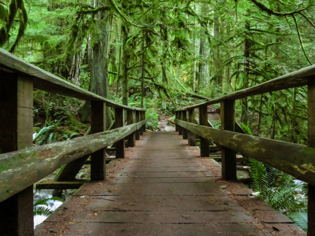
This is one of my favorite year-round hikes near Vancouver. The hike (via Nelson Creek) starts just off of the highway near Horseshoe Bay and quickly turns into a deep forest paradise.
The hike has a gradual slope the whole way to the lake so it may be considered moderate for some but it is pretty easy in comparison to some of the hikes later on this list.
The hike takes you through a beautiful green forest dripping in moss and ends at Whyte Lake which is a small lake with a dock where you can swim in the summer.
You can walk around to the other side of the lake or take the connector trail to Cypress Falls if you are keen on walking a bit further.
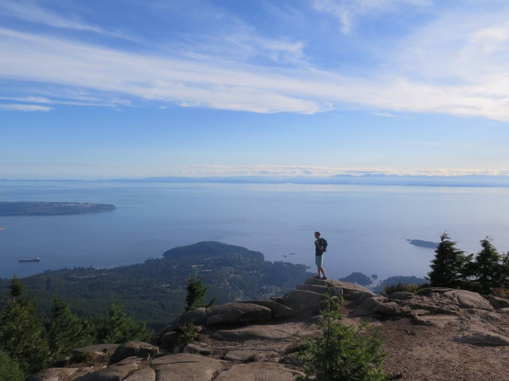
5. Bowen Lookout
Distance: 4.5km | Elevation Gain: 150m | Difficulty: Easy
This short trail is often a stop over on the way to Saint Marks Summit at Cypress Mountain in the summer but in the winter it is a very popular snowshoe trail and is a great option for a quick workout or nature outing any time of year.
This trail has a nice gradual inclide that leads you to a view of the city and ocean. It’s a decent reward for a fairly easy hike.
Be sure to take your time going back through the forest by Yew Lake and take in all of the varied flora in the area.
6. Brothers Creek Lost Lake and Blue Gentian
Distance: 8.5km | Elevation Gain: 400m | Difficulty: Moderate
This is a great trail to do in June and later as the snow around the lakes melts, but you can do it earlier if you want to cut it a little short. In the winter months, you can take this trail halfway up and cut across the river to avoid the deep snow.
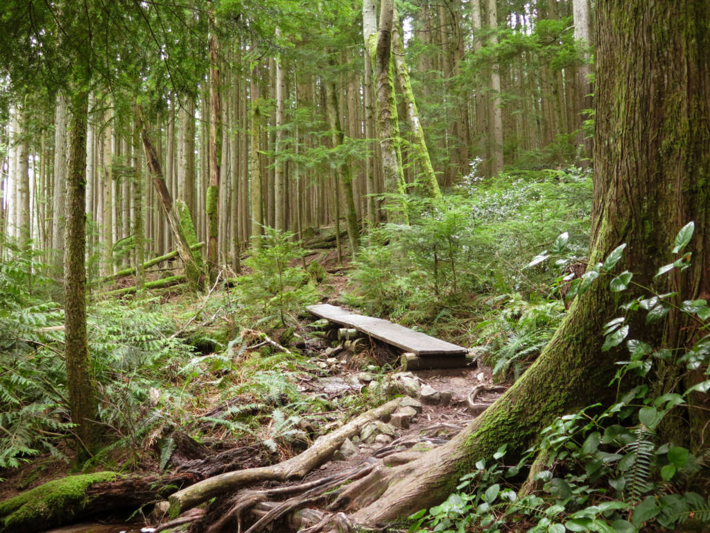
The trail takes you up a gradual incline through a dense forest and loops around two lakes. There are also two waterfalls on this trail, one is near the top of the trail and is easy to miss and the other is hard to miss and is along the bottom of the trail on the Baden Powell section.
This trail can be a little hard to follow at times so I would recommend downloading a trail map before you go.
7. Saint Marks Summit
Distance: 10.5km | Elevation Gain: 600m | Difficulty: Moderate
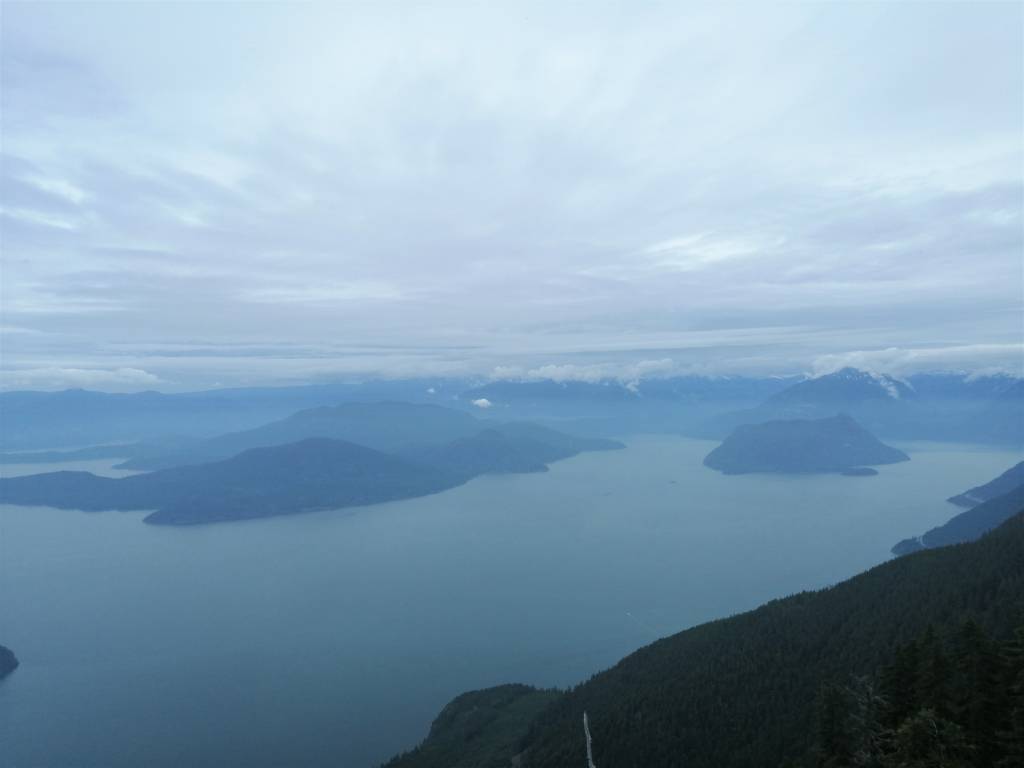
This is one of Vancouver’s most iconic hikes due to its big Howe Sound views combined with the moderate difficulty of the trail.
This trail starts at Cypress Mountain and has varied terrain with some switchbacks, some steep parts, small lakes, and Bowen Lookout as a short detour on the way. At the end, make your way towards the cliff edge for some big sweeping views.
This trail is very popular so please be respectful of your fellow hiker and follow Leave No Trace principles. Only do this hike in the summer (July to September). Some people will attempt this hike in the snow but it is not safe.
8. Eagleridge Bluffs
Distance: 8.5km | Elevation Gain: 450m | Difficulty: Moderate
This is another very popular hike in Vancouver, and again because it has stunning views of the ocean and the city while still being a somewhat moderate trail.
This trail starts at Cypress Mountain and travels next to the ski run for the first two kilometers which is a steep grind, though you will still get little peekaboo views of the mountains to keep you motivated. After two kilometers the trail will flatten out and you will find Cabin Lake which is great for a quick swim if you are up for it.
After traveling on mostly flat ground for a little while you will descend again until you hit Eagle Bluffs which is a massive rock outcropping that is fun to explore while you take in the views.
On the way back you have to climb the descent, you took before the viewpoint and it is tiresome to go uphill on the way home so be sure to preserve some energy for that.
You can also do this trail in the winter on snowshoes or with microspikes, but don’t do this trail in shoulder season when there is snow melt and ice.
9. Hollyburn Peak
Distance: 9km | Elevation Gain: 450m | Difficulty: Moderate/Challenging
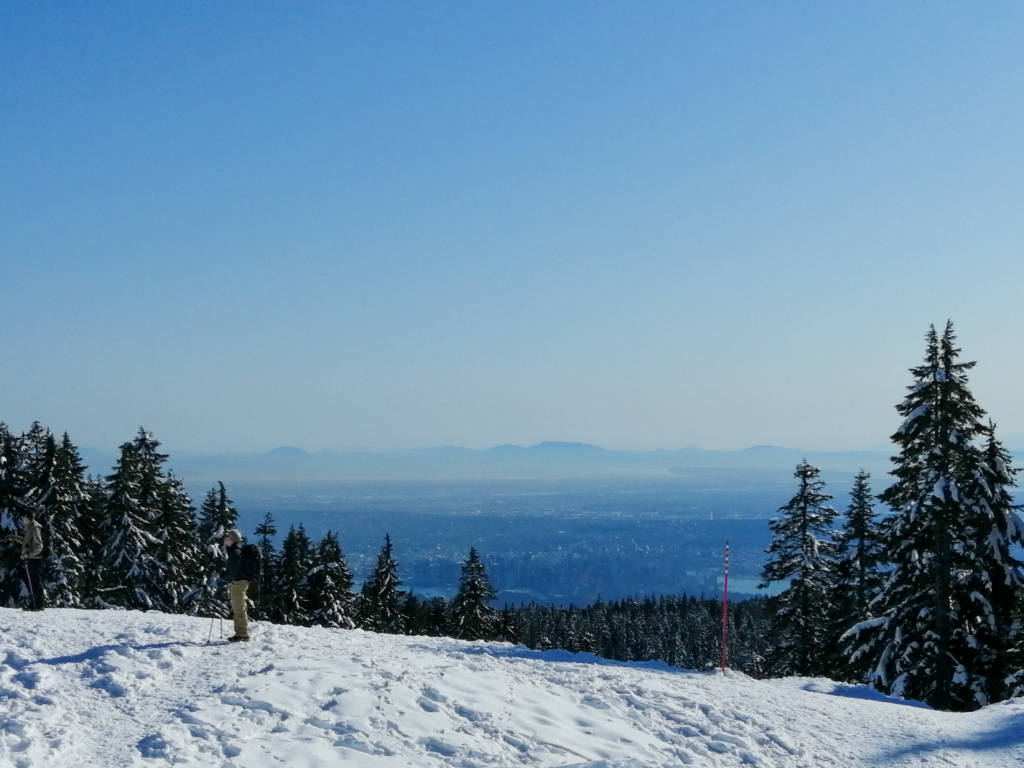
This trail starts near the nordic skiing area on Cypress Mountain takes you to the top of Hollyburn Mountain where you will get views of the city and the surrounding mountains.
The trail starts out moderate and then makes a steep turn upwards shortly before the summit that is definitely challenging. The views at the end, and along the way will make it all be worth it.
In the winter this is a popular snowshoe/microspike trail. The winter and summer trails are slightly different so be sure you have the correct map downloaded depending on what season you are going in.
10. Mount Strachan
Distance: 7.5km | Elevation Gain: 600m | Difficulty: Challenging

This is a fantastic leg burner of a hike at Cypress Mountain that is underrated. The hike takes you up a very steep slope, past a crashed small plane, and onto two summits.
As you hit the first summit you will think you have reached the end but be sure to take the trail that leads into a gully then back up the following mountain for epic 360 views where the mountains seem to go on forever.
On your way up I would recommend skipping the small portion of the Baden Powell trail and walking straight up the “Collins” ski run before cutting into the trail where they run close together.
Be prepared with good sun protection, lots of water, and plenty of snacks to revive your energy stores. Only go in the summer months (July to September) so as to avoid snow.
11. Unnecessary Mountain
Distance: 16km | Elevation Gain: 1100m | Difficulty: Challenging
This is the next peak after Saint Marks Summit on the Howe Sound Crest Trail, where the trail becomes much quieter after you pass the famous St Marks viewpoint, but the views will only get better.
After Saint Marks, the trail becomes quieter but a bit more challenging as you will be heading further uphill and summiting another mountain. Be aware that this isn’t just an easy jaunt from Saint Marks so be sure to go prepared for a solid day of hiking. You will be highly rewarded with incredible views in every direction.
The best time to do this hike is between July and September.
12. West Lion
Distance: 20.5km | Elevation Gain: 1450m | Difficulty: Challenging
The typical hike to reach The Lions starts at Lions Bay but there is another route along the Howe Sound Crest Trail (after St Marks Summit and Unnecessary Mountain). This trail is definitely challenging and you should allow the whole day to complete it and pack plenty of food and water to sustain you.
At the end you will be wildly rewarded with incredible views in every direction and an intense feeling of satisfaction to reach the top of Vancouver’s most iconic skyline mountain.
13. Howe Sound Crest Trail
Distance: 26.5km | Elevation Gain: 2500m | Difficulty: Challenging
I have mentioned the Howe Sound Crest Trail three times on this list as it has St Marks Summit, Unnecessary Mountain, and West Lion summits all on this one trail. The entire trail is a point to point trail that starts at Cypress Mountain and ends at Lions Bay. To be able to do this trail you will need two cars or a very good friend to drop you off/pick you up at the start/end.
This trail is frequently done as a two-day excursion but for the very determined it can be done in one day. Only do this trail if you are a very experienced hiker and know your body can hike for long distances at a time.
If you choose to do this trail (accessible July to September) you will be incredibly rewarded with amazing views and the wilderness largely to yourself.
Conclusion
West Vancouver has some stunning trails to explore in the summer and year-round. Again, if you are looking for the hikes of the neighboring North Vancouver, find them here. Happy hiking!


Welcome to Alpine Feeling! My name is Talon, an outdoor enthusiast who has spent extensive time in the mountains of Vancouver, Washington State, and the Canadian Rocky Mountains.