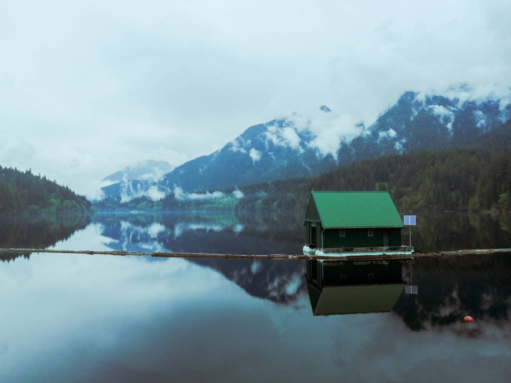
My best suggestion for solo hiking in Vancouver, especially if you are new to hiking alone, is to stick to trails that are populous and easy to follow. There will not be any deep backcountry hikes on this list.
If you are an experienced solo hiker and want to experience something quieter I recommend checking out some of my other articles such as Vancouver Hikes Ranked by Difficulty. Another thing you may be interested in as a solo hiker if you do not have a car is Hikes Accessible by Bus in Metro Vancouver.
If you choose to drive to a remote hike, be sure to be prepared with a spare tire and anything you may need if your car breaks down and you do not have cell service to call for help. Of course, any hike can be a solo hike, but these are hikes that I think are the better options, especially for those new to solo hiking or new to the area.
Always be prepared, check recent trail reports, and alert someone of your location before you leave and after you return. Remember that the best thing about solo hiking is self-sufficiency so be sure to carry the 10 essentials.
The following hikes are grouped by location and organized by approximate difficulty.
Safe Solo Hikes Near Vancouver, BC
Table of Contents
Vancouver’s North Shore
1. Lynn Canyon
Distance: 3km | Elevation Gain: 150m | Difficulty: Easy
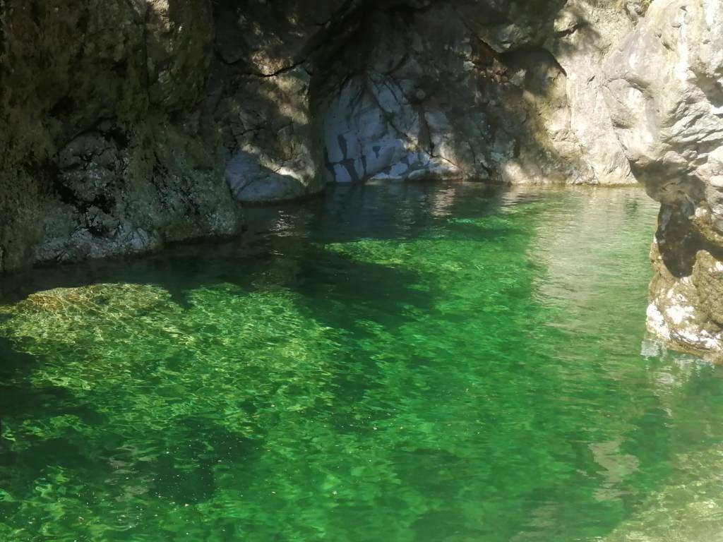
The gorgeous park in North Vancouver is fantastic year-round and in any weather. I particularly like going here on a rainy day because it is quieter than usual.
The main loop around the park takes you over an iconic suspension bridge, along a beautiful clear blue river, and past several other attractions along the way. If you want to extend the trail I would recommend continuing to Rice Lake.
This is an easy hike with a big parking lot, is bus acessible, and has well-marked trails. It would be difficult to get lost here and if you twist an ankle there will definitely be someone around to help you out.
2. Capilano Canyon
Distance: Up to 8km | Elevation Gain: Up to 300m | Difficulty: Easy
This park is in North Vancouver and it is an underrated gem in Vancouver and it is easily accessible by car and by bus. The park has beautiful hiking year-round and in any weather. There are several bridges, a beautiful canyon cut by a blue river, and a dam with views of the mountains.
It would be hard to get lost as the park has neighborhoods on all sides and there are usually plenty of people to help if you need it. However, I would recommend downloading a map of the area before you go because there are many intersecting trails. Read more about my favorite trails in Capilano Canyon here.
3. Lighthouse Park
Distance: Up to 6km | Elevation Gain: 200m | Difficulty: Easy
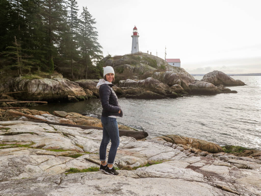
This park is in West Vancouver on the ocean, it features views of the surrounding islands, the city, and of course the iconic lighthouse.
There are many different trails here (download a map before you go) that offer varied terrain and difficulty. This park is just as beautiful in the rain so take your rainboots and enjoy the stormy weather if you enjoy that, and go year-round!
There is a parking lot here but it can fill up on a sunny day. The park is also accessible by public transit if you want to avoid the parking altogether. Find out more about Lighthouse Park here.
4. Quarry Rock
Distance: 3.7km | Elevation Gain: 200m | Difficulty: Easy

This is an iconic hike that starts from the town of Deep Cove in North Vancouver. The town is adorable and the hike is fairly simple and can be completed year-round.
You will travel through the forest and over several bridges and up and down stairs until you reach a big rock outcropping with views of Deep Cove and the city over the water. It’s a beautiful little hike that is hard to go wrong with and there are usually plenty of people around to help.
Read more about some of the trail extensions you can do from Quarry Rock here.
5. Whyte Lake
Distance: 5km | Elevation gain: 200m | Difficulty: Easy
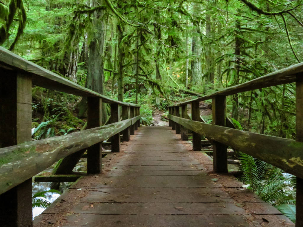
Whyte Lake is one of my favorite off-season hikes. It can be done year-round as is just as beautiful in the rain as it is in the sun (but beware of mud in the rainy season).
The lake at the end is small with a little dock where you can swim in the summer if you are keen but the real wow factor comes from the forest you walk through on the way there. The trees are coated in beautiful green moss and you walk along a river with some small waterfalls. It is truly beautiful.
It is hard to get off the trail here and it is a fairly popular spot so you shouldn’t find yourself in any distress.
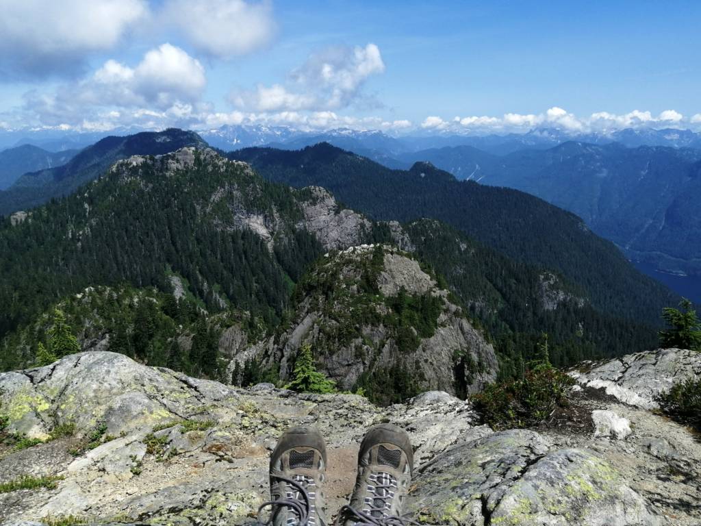
6. Dog Mountain
Distance: 5.5km | Elevation Gain: 200m | Difficulty: Easy/Moderate
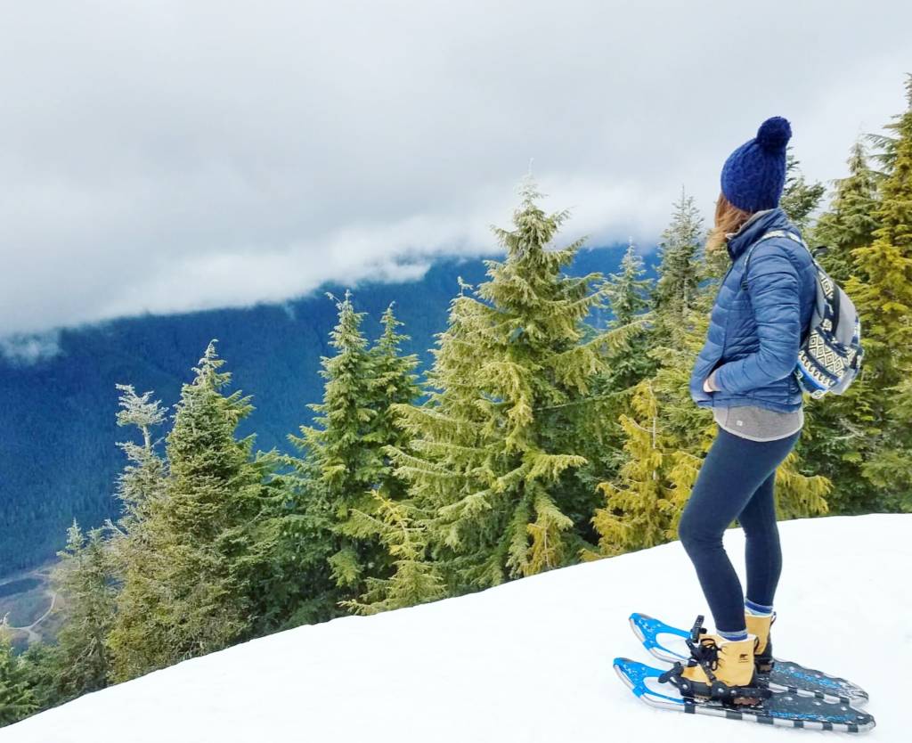
This is a straightforward hike that starts at Mount Seymour and can normally be done snow-free between June and October but is also a great snowshoe (or microspike) trail between December and March, especially for those new to winter hiking.
The trail is well marked and not too difficult, you will be rewarded with views of the ocean, islands, and the city.
7. NorVan Falls
Distance: 14km | Elevation Gain: 350m | Difficulty: Moderate
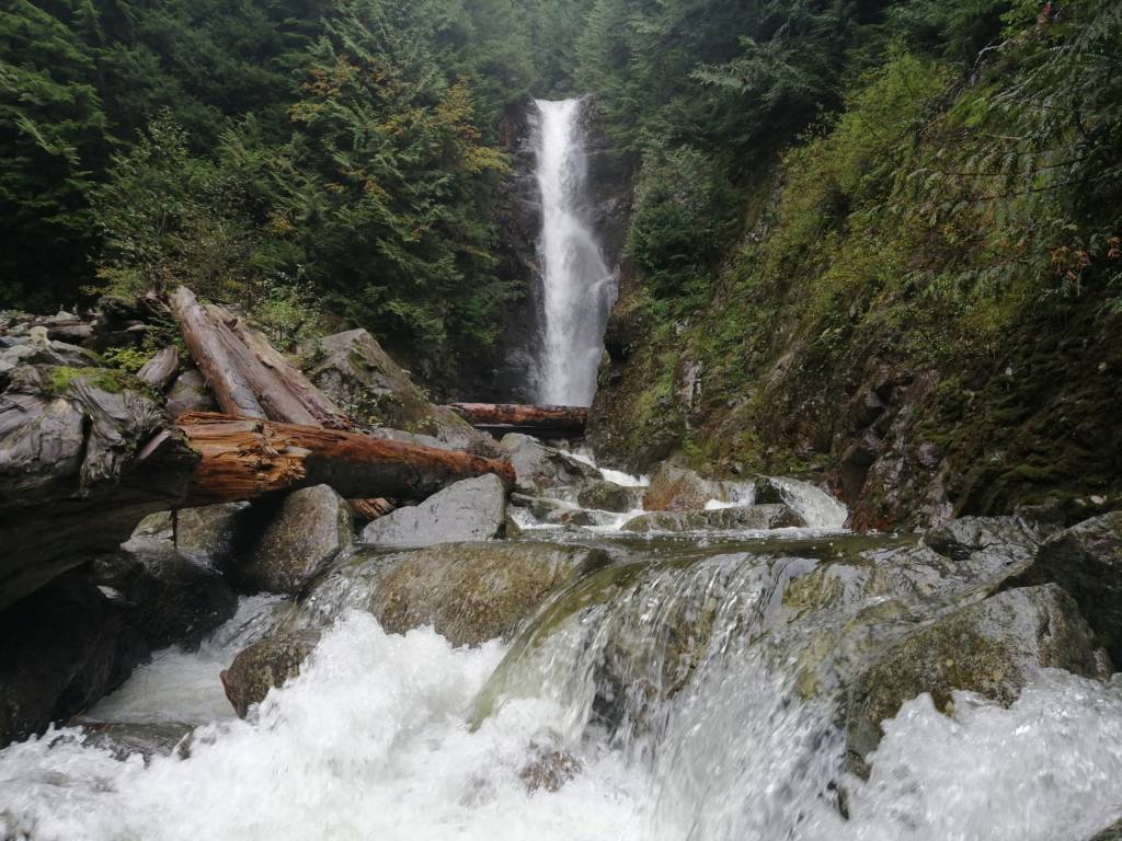
This trail is at Lynn Headwaters and it is fairly straightforward. There is no cell service on the trail but there are almost no turn offs and there is a big map at the front of the park and some smaller ones along the way. The trail is quite popular so you will have plenty of people around for help if you need it.
There is a large parking lot that is paid and still manages to fill up quickly on the weekend. This area is also accessible by bus, but it adds 1km to the hike on either end.
The falls at the end are tall and plunging and it is well worth the trek. I love to do this hike in the rain because you are largely sheltered by trees and the view is not obstructed by clouds.
There are some other great hikes within this park that are steep, challenging, and less popular but have big mountain views if you are looking for something quieter during the summer months. Of course, be fully prepared for these hikes as they are not as foolproof as NorVan Falls. The other hikes include Coliseum Mountain and South Needle.
8. The Grouse Grind or BCMC
Distance: 3km | Elevation Gain: 800m | Difficulty: Moderate/Challenging
This isn’t so much of a hike, but more of a fitness challenge that is iconic in the Vancouver area. This trail takes about 1 hour and it is basically just a big Stairmaster going up the side of a mountain, through the woods, to the Grouse Mountain Resort.
The trail is incredibly popular and you will not be able to get lost. The trail is so popular that you are actually not allowed to go down it. To get down, you have to purchase a downloading ticket on the Grouse Mountain Gondola or you can go down the neighboring BCMC trail, which is not as popular or built up but just as steep.
At the top of the climb, you will feel impressed with your body and you can explore the resort where you can find various nature shows, shopping, and dining.
Several other hikes are at the top of Grouse Mountain, such as Goat Mountain and Crown Mountain (find more about them on my guide to North Vancouver hikes). These trails are not as well marked, more rugged, but still beautiful if you want to push yourself further and get away from the crowds (these trails are better done with a partner or by someone comfortable with solo hiking).
The Grouse Grind is usually open between May and October and is accessible by bus.
9. Eagleridge Bluffs
Distance: 8.5km | Elevation Gain: 450m | Difficulty: Moderate
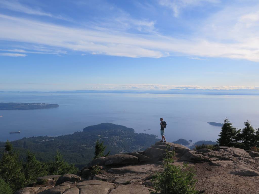
This is a great summer hike at Cypress Mountain (July to October) that leads you to a beautiful bluff with big views of the ocean and the city. The bluffs are massive and fun to explore or relax on with a book or a picnic.
The beginning of the hike is quite steep until you get to Cabin Lake, which is a great place to stop and take a swim if you are interested. The hardest part about this hike is that you have to go downhill to get to the viewpoint, and having to climb uphill on the way back is always draining.
This is a popular trail with lots of markers to tell you which route to take so you shouldn’t have to worry too much about getting lost.
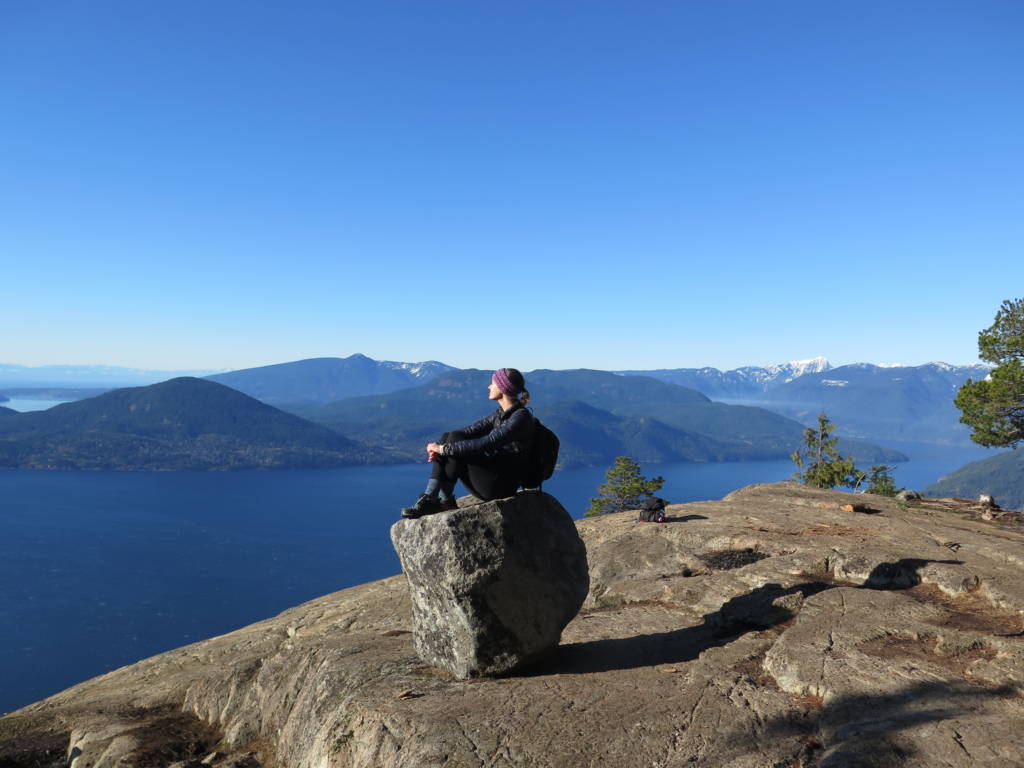
10. Saint Marks Summit
Distance: 10.5km | Elevation Gain: 600m | Difficulty: Moderate
This is one of Vancouver’s most iconic hikes. It starts at Cypress Mountain, takes you along the Howe Sound Crest Trail, and brings you to a cliff with big views of the Howe Sound. The trail is very popular so though there are a few trail junctions along the way, it is easy to follow the people up the mountain.
This hike is best done between July and October, please do not do this hike in the snow, it can be dangerous.
11. Mount Seymour
Distance: 7 to 8.2km | Elevation Gain: 500 to 600m | Difficulty: Moderate/Challenging
This is a very fun trail at Mount Seymour that has three peaks, each with a gorgeous view, so you can stop at whichever one you feel content at. This trail is well maintained and popular, so though there are a few junctions, it is not hard to follow.
The trail is diverse with changing terrain, flowers, and big boulders. The view from the first peak is of the city and the ocean and the views from the second and third peak are of the mountains. I would rate peak one as moderate, but I would rate the whole trail as challenging if you choose to keep going to all three peaks.
In the winter this is also a popular snowshoe trail (microspikes should suffice) and is a good choice for those looking to push themselves a bit harder in the snow than Dog Mountain. This trail should be done between July and October for hiking or December to April for snowshoeing.
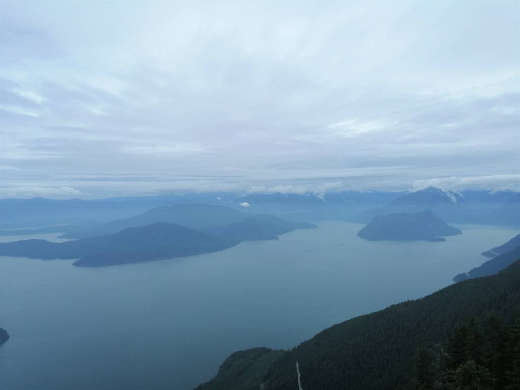
Sea to Sky Highway
12. Tunnel Bluffs
Distance: 11km | Elevation Gain: 550m | Difficulty: Moderate
This is another one of Vancouver’s most iconic hikes that leads you to a rock outcropping with beautiful views of the Howe Sound and the Garibaldi Mountains.
The hike starts at Magnesia Creek in Lions Bay (note that the parking lot is very small and is paid in the summer, but you can park a little further down the road at the elementary school for free). It is a very popular, well-maintained, and straightforward hike. There are a few trail junctions but they are mostly well marked so there shouldn’t be much chance of getting lost.
This trail is typically snow-free from April to October, but it can be snow-free year-round. In the winter the trail can turn into a giant sheet of ice and if it gets warm enough to melt, the trail turns into pure mud, so I would recommend checking recent trail reports and considering recent weather conditions before you go in the winter.
If you want to do a harder hike, this trail also stems off into The Lions and Mount Brunswick, which are fairly popular as well, but please know these are very challenging hikes that will take you all day and you need to be well prepared for.
13. The Stawamus Chief
Distance: Up to 6km | Elevation Gain: Up to 650m | Difficulty Moderate to Challenging
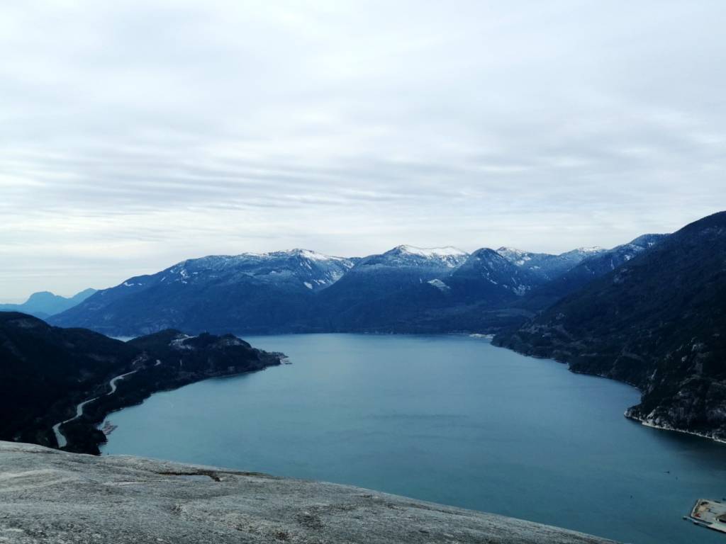
A very famous hike just south of downtown Squamish. This hike is well worn and well marked. There are three peaks, so you can choose your own route depending on how far you want to go, all three peaks have beautiful views so you will not miss out if you choose one over another.
The trail goes straight up this giant rock mountain over many sets of man-made and nature-made stairs as well as a few ladders and rope-assisted sections, it’s a tough but exciting climb. At the top, you will find views of Squamish, the Howe Sound, and the Garibaldi Mountain Range.
This hike is snow-free between April and October, but it can be done year-round if the weather cooperates. The trail and the summit include a lot of exposed rock which can be very slippery when the mountain is covered in ice so be sure to bring microspikes and check the recent trail reports and The Chief webcam before you go.
14. Elfin Lakes
Distance: 20km | Elevation Gain: 800m | Difficulty: Moderate
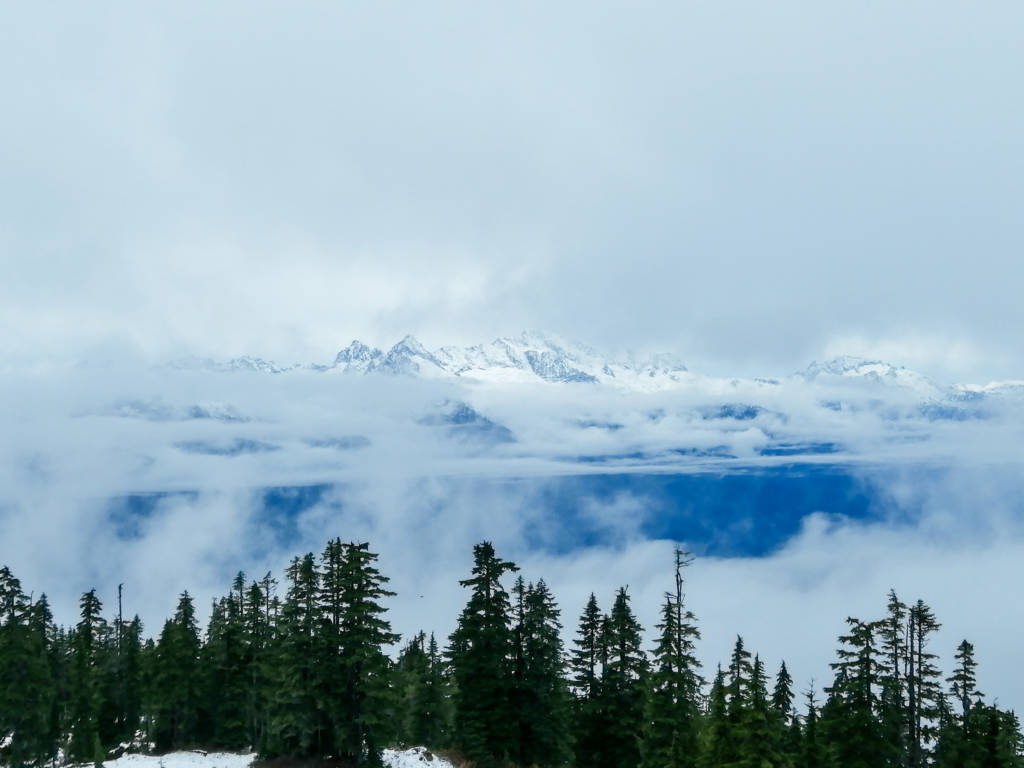
The Elfin Lakes trail may seem long but it is not too challenging as the hike is straightforward with a nice gradual elevation gain. The trail is very clear for the first 5km until you reach Red Heather Hut, and then after that, the trail diverges into a hikers trail and a bike path, still easy to navigate the rest of the way to the lakes.
This trail leads you to a series of small lakes that are surrounded by mountains. There is also a campsite there with tent pads, bear hangs, and a shelter. If you are new to backpacking and solo backpacking, this could be a great place to try a multi-day hike for the first time.
Please note that Elfin Lakes starts at Diamond Head parking lot which is at the end of a forest road which means no cell reception and no services. The trail is popular so if you have car troubles you should be able to find help but never assume that will be the case and be sure to bring things like a spare tire and a blanket.
This hike is snow-free between July and September but can also be done on snowshoes between December and April.
15. Garibaldi Lake
Distance: 19km | Elevation Gain: 1000m | Difficulty: Moderate
Garibaldi Lake is a beautiful blue glacial lake north of Squamish. The hike is a steady climb through the forest which is easy to follow. The trail is definitely popular so you should have plenty of people around to assist you if needed.
Past the lake you can find trail extensions to Panorama Ridge and Black Tusk, most people do these hikes in two days after stopping to camp at Garibaldi Lake where there are tent pads, a bear hang, and a pit toilet. I think this is probably the best place to take your first backpacking or solo backpacking trip near Vancouver. The campsite at the lake is usually full so there will be plenty of people to help you with anything you need and to ward off bears. Be sure to get your permit in advance.
The trail to the lake can be snow-free as early as late April/May but the extensions will have to wait until July. The lake will also be frozen over until mid-summer.
This trail starts at the Rubble Creek parking lot which is easy to access with a regular vehicle.
Tri-Cities & Maple Ridge
16. Jug Island
Distance: 5km | Elevation Gain: 200m | Difficulty: Easy
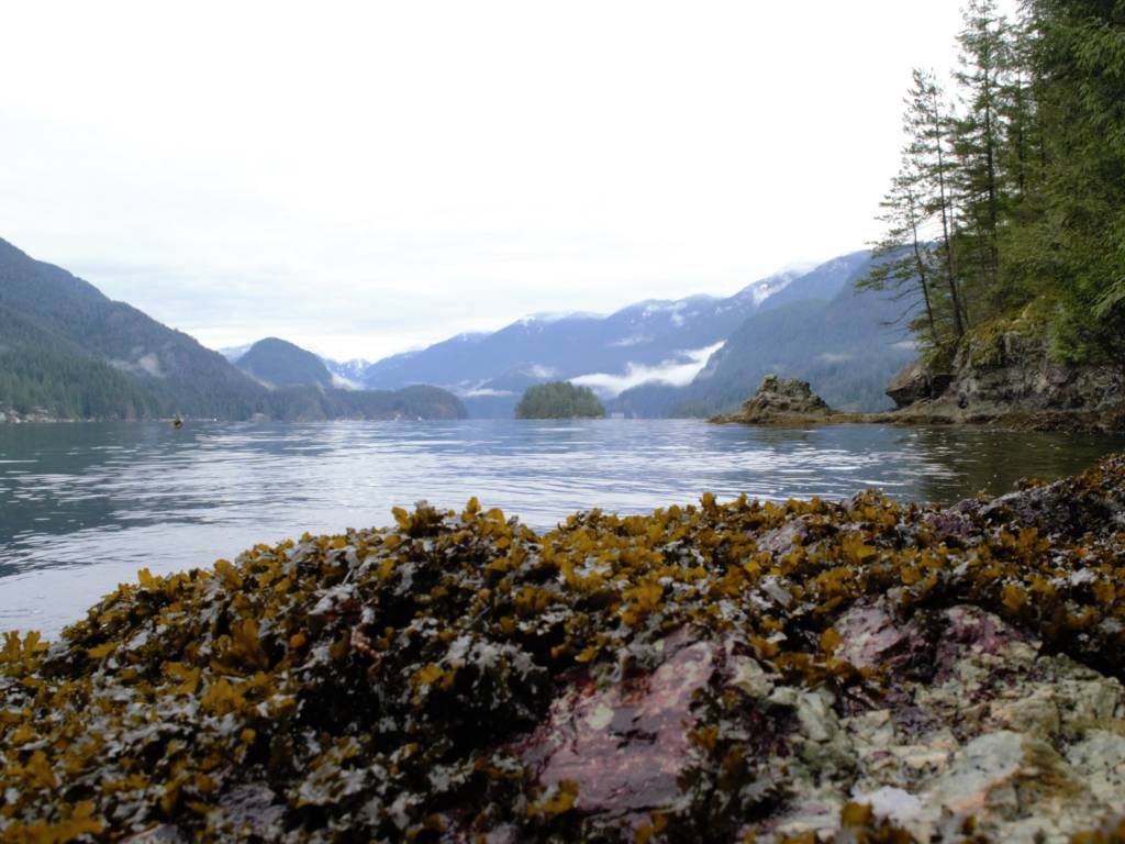
This is a lovely easy hike in Belcarra that is well marked and easy to follow. It is a fairly popular trail so you will see people along the way. This is a year-round all-weather hike that leads you to a small beach with views of the mountains and Jug Island itself.
This hike has plenty of neighborhoods around so it’s hard to get lost. This hike also has public transit access and a large parking lot (that is paid). If you are driving be sure to input directions to the Belcarra Picnic Area into Google rather than the Jug Island trailhead.
17. Gold Creek
Distance: 5 to 10km | Elevation Gain: 50 to 350m | Difficulty: Easy/Moderate
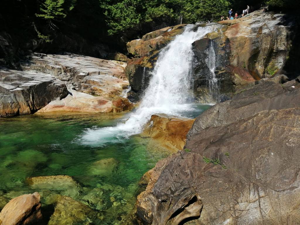
There are many different trails around Gold Creek in Golden Ears Provincial Park, hence, there is not a set distance or difficulty level written above. There is the East/West Canyon Loop, the East Canyon to Upper Falls Loop, and the Lower Gold Creek Falls trail.
The trail to the lower falls is the most popular and the easiest which takes you to falls that are popular for swimming in the summer. The other two take you around the edge of the river and to another set of falls. These trails are usually snow-free year-round.
Another good option for Golden Ears Park is the trail to Golden Ears summit, this trail is challenging and will take all day or two days. It is still busy so you would have help along the way if needed. Read more about Golden Ears in my complete guide here to find the best trail for you.
18. Buntzen Lake
Distance: 10.5km | Elevation Gain: 300m | Difficulty: Easy/Moderate
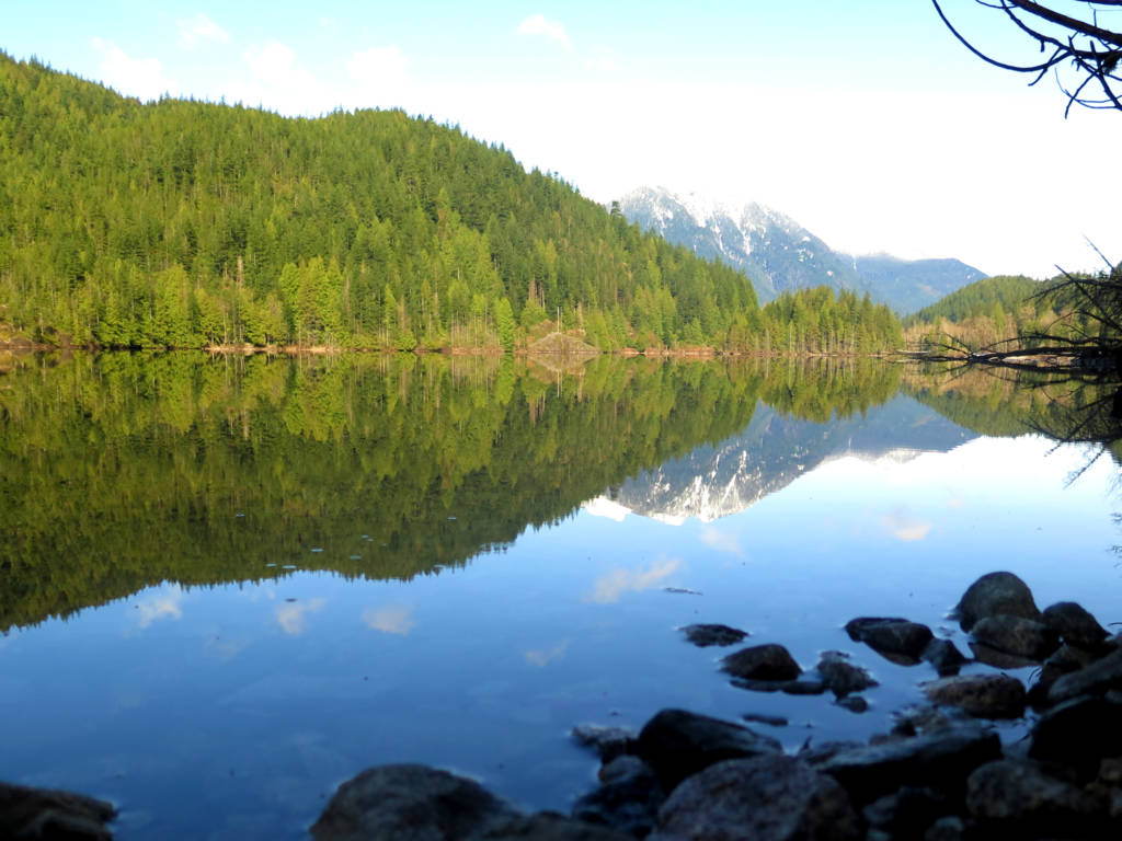
This stunning lake has a loop that goes right around the edge of it, making it very difficult to get lost. The trail is beautiful and popular and can be done year-round and in any weather.
Above the lake you can also take the trail to Dilly Dally Loop or Diez Vistas, these trails are much harder and can only be done in the summertime and they can be confusing at times at trail junctions; however, they are still significantly popular so you can ask for directions if needed.
Note that the parking lot fills up very quickly on sunny summer weekends so arrive early if you want a spot.
Fraser Valley
19. Lindeman Lake
Distance: 3.5km | Elevation Gain: 250m | Difficulty: Easy/Moderate
Lindeman Lake is a beautiful clear blue glacier lake near Chilliwack Lake Park. The hike to get to it is steep and rocky but pretty short and quite popular. The hike can usually be done year-round, but I would not recommend doing it in the rain as the rocks underfoot can be slick. There is a small campsite at the lake and plenty of places to layout on big rocks to soak in the sun and go for a chilly dip.
The road is long to get there but all paved and fairly popular with campers and other lake goers.
20. Teapot Hill
Distance: 5km | Elevation Gain: 250m | Difficulty: Easy
This simple hike is located at Cultus Lake and features nearly 100 teapots and saucers to be found in the forest! It is a very fun hike that can be done year-round and in any weather. The trail is a steady incline the entire way but nothing too challenging. This trail is definitely popular and easy to follow so there shouldn’t be many concerns.
21. Elk Mountain
Distance: 8.2km | Elevation Gain: 750m | Difficulty: Challenging
This hike starts in Chilliwack and takes you on a steady incline all the way to the summit where you will get beautiful views of the valley and the surrounding mountains, including Mount Baker. If you are up for it, you can continue along the ridge towards Mount Thurston for some more incredible views.
This hike is snow-free between June and October, but it is also a fantastic snowshoe route between December and March.
The road to get to the trailhead is dirt but fairly well maintained and only lasts for a short while. The hike is very popular so you will find plenty of people to help you out if needed, but as always, be prepared.
Happy Hiking!


Welcome to Alpine Feeling! My name is Talon, an outdoor enthusiast who has spent extensive time in the mountains of Vancouver, Washington State, and the Canadian Rocky Mountains.